Which Side Of Kauai Is The Prettiest?
The prettiest side of Kauai is the one you can't drive to. This honest, researched guide compares the north, east, south, west and the Napali Coast so you can pick the side that suits your trip.
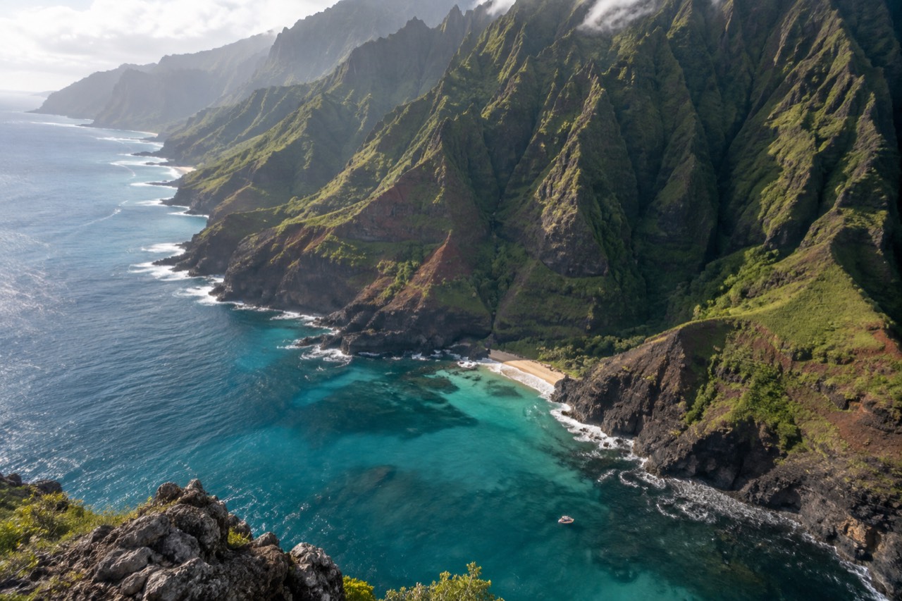
The Napali Coast is the side of Kauai that appears on every postcard, and it is the only side you cannot reach by car. The north shore has Hanalei Bay and green mountains. The east side has the airport and the only navigable river in the state. The south shore has Poipu and the steadiest weather. The west side has Waimea Canyon and the departure harbors for the boat tours that get you to the fifth side. Each of them is beautiful, but one of them is the reason people fly six hours over open ocean. This page walks through all five sides, compares what they offer, and explains how to see the one that has no road.
Napali Coast Boat Tours covers the boat side of that decision, because the coast that wins this question is seen best from the water.
Which Side Of Kauai Is Prettiest?
The Napali Coast, on the northwest shore, is the side most visitors name first. Its 16 miles of sea cliffs, hanging valleys and waterfalls are the island's defining landscape, and it's the only side you can't reach by car. The north shore around Hanalei is a close second, the south shore wins on reliable sunshine, and the east and west sides serve practical roles.
The Napali Coast is not a side you drive to. There is no road past Ke'e Beach, and the only way to see the full 16 miles is by boat, by helicopter or by hiking the 11-mile Kalalau Trail, which requires a permit and a full day each way. That inaccessibility is part of why it stays so striking. The cliffs rise from sea level to 4,000 feet in less than a mile of horizontal distance, and the valleys between them are so steep that the only flat land is on the valley floors, where ancient Hawaiians built stone terraces for taro cultivation. The Hawaii DLNR Division of State Parks describes the coast as "deep, narrow valleys ending at the sea, with waterfalls and streams continuing to incise valleys while the sea carves cliffs" (source). The park that protects it measures 6,175 acres, a figure from the state's own data book.
Most visitors see the Napali Coast on a boat tour, and that is the straightforward answer to the "prettiest" question. A sunset dinner cruise, a snorkel trip or a raft expedition all run the same coastline, just at different speeds and with different stops. The three tours below cover the range: a dinner cruise that catches the cliffs in evening light, a full five-hour catamaran with lunch and snorkeling, and a longer raft trip that gets inside the sea caves when conditions allow.
The north shore, by contrast, is the side you can drive to that still feels remote. Hanalei Bay is a two-mile crescent of sand backed by mountains that catch the clouds, and the town of Hanalei has a handful of restaurants and a pier. It is the closest road-accessible point to the Napali Coast, and it is the only side where you can look west and see the beginning of the cliffs. The north shore gets more rain, which is why it is so green, and it gets the biggest winter surf, which is why the beaches are closed to swimming from October to April. The Kalalau Trail starts here, at Ke'e Beach, and the first two miles to Hanakapi'ai Beach are a popular day hike that needs a Haena State Park reservation.
The south shore is the sunny side. Poipu Beach is consistently ranked among the best beaches in the country, and the water is calm enough for snorkeling year-round. The south shore has the highest concentration of resorts and vacation rentals, and it is the side people choose when they want a beach day that is not weather-dependent. It is also the side closest to the Port Allen departure harbor, which is a 20-minute drive from Poipu, so it is the most practical base for a Napali boat tour.
The east side is the gateway. Lihue Airport, the cruise ship dock at Nawiliwili, and the Wailua River are all on the east side. It is the most developed part of the island, with big-box stores, chain restaurants and the only road that circles the island. The east side is not the prettiest, but it is the most convenient, and it is where most visitors spend their first and last hours on Kauai.
The west side is the dry side, and it is the side people drive through on their way to Waimea Canyon or to a boat tour. Waimea Canyon is a 14-mile-long, mile-wide gorge that Mark Twain called the Grand Canyon of the Pacific, and it is the west side's main scenic draw. The towns of Waimea and Kekaha are small and quiet, and they sit between the canyon and the two west-side harbors, Port Allen and Kikiaola, where every Napali boat tour on this site departs.
The side with no road is the one that wins the question, and the rest of this article walks through each side in detail so you can decide which one fits your trip.
What Is The North Shore Like?
The north shore is the lush, green, cinematic side of Kauai, centered on Hanalei Bay's crescent of sand and mountains. It's the wettest road-accessible area, so it's covered in waterfalls and rainbows, but winter surf closes the beaches. It's also the closest road point to the Napali Coast.
The north shore's beauty is tied to its weather. Mount Waialeale, just inland, is one of the wettest spots on Earth, and the north shore catches the trade winds and the rain they carry. The result is a landscape that is almost unnaturally green, with taro fields in Hanalei Valley and waterfalls that appear after every heavy shower. The downside is that the north shore gets more rain than any other part of Kauai, and the winter months bring big surf that closes the beaches to swimming. The Hanalei buoy, a NOAA wave buoy moored in 200 meters of water off the north shore, records significant wave heights above 2.5 meters about half the time in December and January, based on two recent years of data. That is why the north shore is a summer destination for swimmers and a winter destination for surfers.
Hanalei town is small and walkable, with a few dozen shops and restaurants in plantation-era buildings. The pier at Hanalei Bay is a popular spot for sunset, and the beach park has restrooms, showers and a lifeguard. The north shore also has the only legal kayak landing on the Napali Coast at Kalalau Beach, but that requires a camping permit and a 11-mile paddle each way, and it is not a casual day trip.
The north shore's biggest practical limitation is that it is far from everything else. The drive from Lihue Airport to Hanalei takes about an hour and a half in light traffic, and the road past Princeville is a single lane in several places with one-way bridges. The north shore also has no boat harbor; the Hanalei-based boat operator runs tours off the open bay, and guests park at the operator's office in Hanalei town and take a shuttle to the launch point. That operation is seasonal and weather-dependent, and it is not the most reliable way to see the Napali Coast.
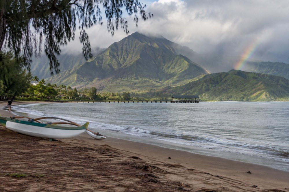
The north shore is the prettiest side you can drive to, and for many visitors it is the highlight of their trip. It is also the side that makes the strongest case for staying in two different places on the same trip: a few nights on the north shore for the scenery, and a few nights on the south shore for the weather and the boat access.
What Is The East Side Like?
The east side is the commercial hub and transportation gateway of Kauai, home to Lihue Airport, the cruise port, and the Wailua River. It's not the scenic star, but it's the most central base for day trips, with affordable lodging and a coastal path in Kapaa.
The east side's coastline is a mix of long, sandy beaches and rocky headlands, and it is the windward side of the island, so it catches the trade winds and gets consistent rainfall. The beaches here are not as sheltered as the south shore, but they are wide and often uncrowded. Lydgate Beach Park has a protected swimming area with a rock wall that creates a calm lagoon, which makes it one of the best spots on the island for families with small children.
The Wailua River is the east side's main scenic asset. Kayak and stand-up paddleboard rentals are available in Kapaa, and a two-mile paddle up the river leads to a trailhead for a short hike to Secret Falls. The Fern Grotto, a lava rock grotto covered in ferns, is accessible by a flat-bottom boat tour that runs several times a day. Neither of these is on the scale of the Napali Coast, but they are pleasant half-day activities that do not require a boat reservation weeks in advance.
Kapaa is the main town on the east side, and it has a long stretch of beachfront with a paved coastal path that runs for several miles. The path is popular with walkers, runners and cyclists, and it is one of the few places on Kauai where you can exercise along the ocean without being on a road. Kapaa also has the highest concentration of affordable restaurants and food trucks on the island, which makes it a good base for budget-conscious travelers.
The east side is not a contender for the prettiest side of Kauai, but it is the side that makes the rest of the island accessible. If your trip is short and you want to see the Napali Coast, Waimea Canyon and the north shore without spending half your vacation in a car, the east side is the most central place to sleep. The drive from Kapaa to Port Allen, where most Napali boat tours depart, takes about 45 minutes, and the drive to Waimea Canyon takes about an hour and a half.
What Is The South Shore Like?
The south shore is the sunniest, driest side, anchored by Poipu Beach's calm coves. It gets less than half the north shore's rainfall, making it the most reliable beach destination. It's also the closest lodging area to Port Allen, the main Napali boat tour harbor.
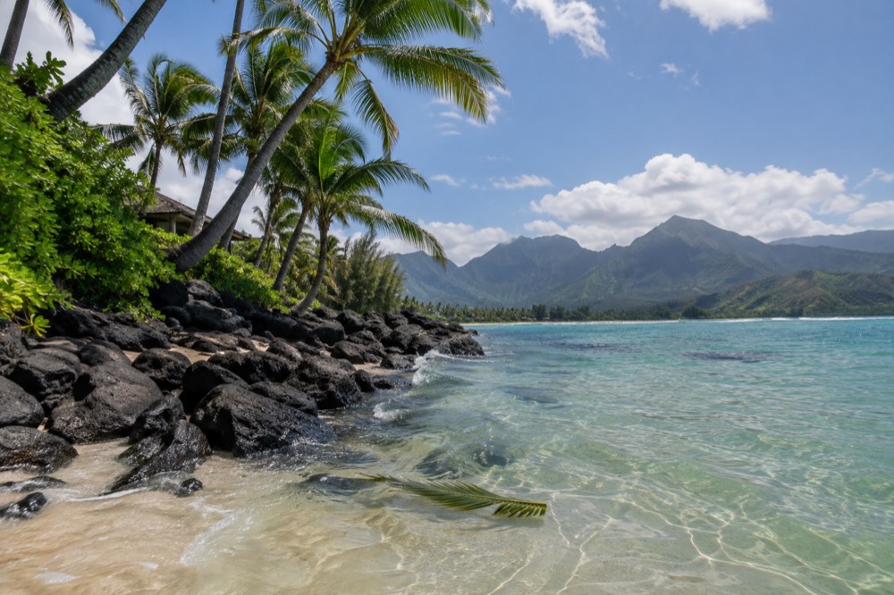
The south shore's weather is its biggest selling point. The area from Poipu to Koloa sits in the rain shadow of the island's central mountains, and it averages about 20 inches of rain per year, compared to over 80 inches on the north shore. The trade winds blow offshore here, which keeps the water flat and the beaches sunny even when the rest of the island is cloudy. That consistency is why the south shore has the highest concentration of resorts, vacation rentals and restaurants on Kauai.
Poipu Beach Park has a lifeguard, restrooms, showers and a shallow protected area that is ideal for children. The beach is also a good spot for snorkeling, with reef fish and the occasional sea turtle close to shore. Shipwreck Beach, a few miles east, is a wider, less crowded beach with stronger surf and a cliff-top trail that leads to Mahaulepu Beach, a remote stretch of sand that is only accessible on foot.
The south shore is also the closest lodging base to the Port Allen departure harbor. The drive from Poipu to Port Allen takes about 20 minutes, which means a morning boat tour does not require a pre-dawn wake-up. That proximity is a real advantage for anyone booking a Napali boat tour, because the check-in times for morning tours are typically between 6:30 and 7:30 a.m., and the drive from the north shore takes over an hour.
The south shore is not as dramatic as the north shore or the Napali Coast, but it is the most comfortable side of Kauai for a beach vacation. It is also the side that gives you the easiest access to the boat tours that reach the prettiest side, a practical consideration that matters more than most travel guides admit.
What Is The West Side Like?
The west side is dry and desert-like, with Waimea Canyon as its scenic highlight. It's the departure point for every Napali boat tour, with harbors at Port Allen and Kikiaola. Most visitors pass through rather than stay, but it's essential for accessing the coast.
Waimea Canyon is the west side's main attraction, and it is worth the drive even if you are not a canyon person. The lookout points along Waimea Canyon Drive offer views that stretch from the canyon rim to the ocean, and on a clear day you can see the island of Niihau on the horizon. The canyon is a 14-mile-long, mile-wide gorge that cuts into the island's interior, and the red and green layers of the rock walls are the result of millions of years of erosion cutting through the shield volcano that formed Kauai. The drive to the top of the canyon, at the Kalalau Lookout, takes about an hour from Waimea town, and the lookout itself is often socked in with clouds by mid-morning, so the best time to go is early.
The west side is also the side where the two Napali boat tour harbors are located. Port Allen Small Boat Harbor, in Eleele, has 34 berths, a loading dock, a fish hoist and restrooms, and it is the departure point for 18 of the 26 tours on this site. Kikiaola Small Boat Harbor, near Kekaha, has four moorings limited to vessels with a draft under three feet, and it is the departure point for the remaining eight tours, mostly rigid-hull raft trips. Port Allen has free public parking in a gravel lot; Kikiaola has paid parking managed by a third party, with free parking for Hawaii residents with a state ID. Both harbors are on the west side, and the drive from Waimea to either takes less than 15 minutes.
The west side is not a place most visitors stay overnight, and it is not a contender for the prettiest side of Kauai. But it is the side that makes the prettiest side accessible, and the boat tours that leave from its harbors are the most reliable way to see the Napali Coast, regardless of the season.
What About The Side With No Road?
The side with no road is the Napali Coast, a 16-mile stretch of sea cliffs, hanging valleys, and waterfalls. It's protected as a 6,175-acre state wilderness park, and it's accessible only by boat, helicopter, or the 11-mile Kalalau Trail. No development, no cell service.
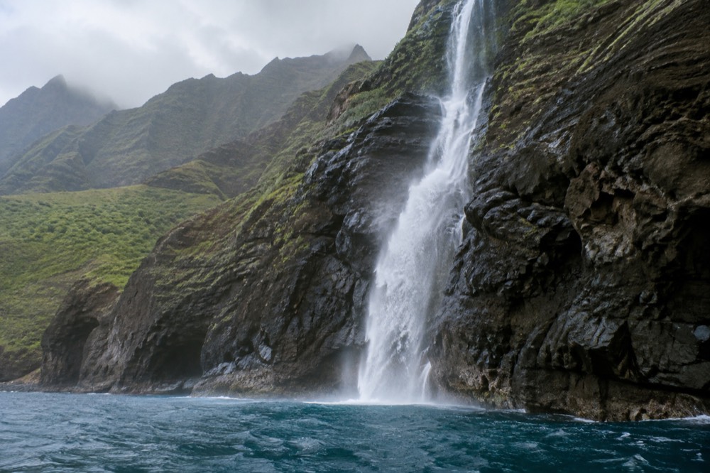
The Napali Coast is protected as the Napali Coast State Wilderness Park, which covers 6,175 acres according to the Hawaii DBEDT Data Book (source). The cliffs are the eroded remains of the Kauai shield volcano, which was built by lava flows between roughly 5.7 and 4.3 million years ago and has been carved by rain and wave action ever since. The valleys between the cliffs were once home to a significant Hawaiian population, and the stone terraces and house platforms at Nualolo Kai are among the best-preserved archaeological sites in the state.
The Kalalau Trail is the only land route into the Napali Coast, and it is an 11-mile one-way hike that crosses five major valleys and gains and loses thousands of feet of elevation. The trail is not a casual walk; the state parks division warns that "for most backpackers in good condition, hiking the 11 miles will take a full day." The first two miles, from Ke'e Beach to Hanakapi'ai Beach, are a popular day hike that requires a Haena State Park entry reservation at $5 per person and a parking reservation at $10 per vehicle. Beyond Hanakapi'ai, hikers need a camping permit, which costs $25 per night for Hawaii residents and $35 for non-residents, with a five-night maximum and a 90-day advance booking window. Permits often sell out months in advance, particularly during the summer.
Helicopter tours are the fastest way to see the Napali Coast, and they offer a perspective that no boat can match: looking straight down into the valleys and seeing the waterfalls from above. The standard minimum altitude for Hawaii air tours is 1,500 feet above the surface under 14 CFR Part 136 Subpart D, which means helicopters are not skimming the cliffs the way a raft does. Helicopter tours also cost more: a 50-minute Kauai Eco Adventure from Blue Hawaiian Helicopters was listed at $409 per person in September 2026, and a 45-minute tour was $499. A boat tour, by comparison, costs between $190 and $361.31 per person on this site's roster and lasts three to eight hours, with food, snorkeling and the chance to get close to the cliffs and sea caves.
A boat tour runs the full 16 miles at sea level, which is the angle from which the cliffs look tallest. The boats stop at snorkel sites when conditions allow, and the smaller rafts can enter the sea caves, which are lava tubes widened by wave erosion, some with collapsed ceilings that create skylights and freshwater cascades into the ocean. No operator guarantees cave entry or snorkeling; both are at the captain's discretion based on swell, wind and visibility. The west-side harbors, Port Allen and Kikiaola, run boat tours year-round, though the product mix shifts with the season: winter tours are more likely to be sightseeing-only, while summer tours include snorkeling and cave stops. If you're planning a trip around the best conditions, our guide on the Napali Coast boat tour season breaks down exactly what runs when.
The Napali Coast is the side that makes Kauai different from every other Hawaiian island. The north shore is beautiful, the south shore is pleasant, but the side with no road is the one that changes how you think about a coastline.
Which Side Suits Which Traveller?
The north shore suits scenery lovers willing to trade some beach days for rain. The south shore is for those who want reliable sunshine and easy boat access. The east side is for budget travelers and short trips. The west side is a day-trip destination. The Napali Coast is for everyone.
The table below matches each side to the type of traveler it suits best.
| Side | Best For | Weather | Boat Access |
|---|---|---|---|
| North Shore | Scenery lovers, hikers, surfers (winter) | Wet, green, big winter surf | Limited; seasonal Hanalei departures |
| East Side | Budget travelers, short trips, central base | Windy, moderate rain | None; 45-minute drive to Port Allen |
| South Shore | Beach vacationers, families, snorkelers | Sunny, dry, calm water year-round | 20-minute drive to Port Allen |
| West Side | Canyon visitors, boat tour departure point | Dry, hot, desert-like | Port Allen and Kikiaola harbors |
| Napali Coast | Everyone; the reason to visit Kauai | No road, seen by boat or helicopter | Boat tours year-round from west-side harbors |
The Napali Coast is not a place you stay, but it is the side that shapes the whole island's identity. The north shore and the south shore are the two places people actually sleep, and the choice between them comes down to weather and proximity. The north shore is more beautiful on a clear day, but the south shore has more clear days. The south shore is closer to the boat harbors, but the north shore is closer to the Kalalau Trail. A split stay, with a few nights on each side, is the best way to experience both, but it adds a packing and moving day that not every itinerary can absorb. For a deeper look at timing your visit, our post on the best time to visit Kauai covers the seasonal trade-offs in detail.
The east side is the compromise: less scenic, less sunny, but central and affordable. The west side is not a place to stay, but it is the place to leave from. Every boat tour on this site departs from the west side, and the drive from any base on the island to Port Allen or Kikiaola is manageable in a morning.
How Do You See The Fifth Side?
The Napali Coast is seen by boat, helicopter, or on foot. A boat tour runs the full 16 miles at sea level, includes food and snorkeling, and costs $190 to $361.31 per person. Helicopter tours offer a top-down view but are pricier. The Kalalau Trail is for experienced backpackers.
The boat tour is the practical choice for most visitors. The west-side harbors at Port Allen and Kikiaola run tours year-round, and the roster on this site covers everything from a 3.5-hour sunset dinner cruise to an 8-hour Niihau snorkel expedition. The boats range from large power catamarans with 49 passengers to small rigid-hull rafts with 14, and each type offers a different trade-off between comfort and access. The catamarans are stable and have shade, restrooms and full meals, but they cannot enter the sea caves. The rafts are fast, open and can nose into the caves when conditions allow, but they are wet, bumpy and not suitable for anyone with back or neck problems.
The helicopter tour is the only way to see the interior of the valleys and the waterfalls that are hidden from the sea. The view from above is spectacular, but it is also brief: a typical tour lasts 45 to 55 minutes, and the minimum altitude rule means the helicopter is not getting close to the cliffs the way a boat does. The cost is also a factor: a helicopter tour is $309 to $499 per person, while a boat tour is $190 to $361.31 and lasts three to eight hours. The two experiences are complementary, not substitutes, and some visitors do both.
The Kalalau Trail is the most immersive way to see the Napali Coast, but it is also the most demanding. The trail is 11 miles one way, with no water, no shade and several sections of narrow, exposed trail with steep drop-offs. The state parks division recommends that only experienced backpackers attempt the full trail, and the permit system limits the number of people on the trail at any one time. The day hike to Hanakapi'ai Beach is a more accessible option, but it only covers the first two miles and does not reach the heart of the coast.
The boat tour is the option that works for the widest range of people, and the sunset dinner cruise is the one that pairs the scenery with the best light of the day.
The sunset dinner cruise departs Port Allen in the late afternoon, runs the full Napali coastline, and serves a plated dinner while the cliffs turn gold and then pink in the fading light. The tour lasts 3.5 hours and costs from $247 per person, with a 4.7 rating from 104 reviews on the live listing. It is the most comfortable way to see the prettiest side of Kauai without committing to a full day on the water.
The longer snorkel tours, like the five-hour catamaran trip on the Amelia K or the raft snorkel adventure, add a snorkel stop and a cave approach when conditions allow. The Amelia K tour includes lunch, departs Port Allen, and has a 4.9 rating from 2,050 reviews.
The raft snorkel tour is a more adventurous alternative, with a smaller group and the chance to enter sea caves when the swell permits.
The raft snorkel tour runs 5 hours 30 minutes, includes breakfast, and carries a maximum of 14 guests, with a 4.8 rating from 1,656 reviews. Both are solid options for people who want to spend more time on the water and get in the ocean, not just look at it.
The side with no road is the one that defines Kauai, and the boat is the tool that gets you there. The other four sides are the places you stay, eat and drive through, and each of them has its own kind of beauty. But the side that answers the question is the one that looks like the edge of the world from the water.
Common Questions About Kauai's Prettiest Side
Which side of Kauai is the prettiest?
The Napali Coast, on the northwest shore, is the side most visitors name first. Its 16 miles of sea cliffs, hanging valleys and waterfalls are the island's defining landscape, and it is the only side you cannot reach by car. The north shore around Hanalei is the prettiest side you can drive to.
Can you drive to the Napali Coast?
No. There is no road past Ke'e Beach on the north shore. The only ways to see the Napali Coast are by boat, by helicopter or on foot via the 11-mile Kalalau Trail.
Which side of Kauai has the best weather?
The south shore around Poipu has the sunniest and driest weather. It sits in the rain shadow of the island's central mountains and averages about 20 inches of rain per year, compared to over 80 inches on the north shore. The south shore also has the calmest water for swimming and snorkeling.
Is the north shore or south shore better for a boat tour?
The south shore is more practical for a boat tour because it is a 20-minute drive from Port Allen, where most Napali boat tours depart. The north shore is over an hour from the west-side harbors, and the seasonal Hanalei boat operation is less reliable. The boat tour itself runs the same coastline regardless of where you sleep.
What is the best way to see the Napali Coast?
A boat tour is the best way for most people. It runs the full 16 miles at sea level, includes food and often snorkeling, and costs between $190 and $361.31 per person. A helicopter tour is faster and offers a top-down view, but it costs more and stays at a higher altitude. The Kalalau Trail is the most immersive option but requires a permit, a full day each way, and a high level of fitness.
How far is the Napali Coast from the south shore?
The Napali Coast is not directly accessible from the south shore by road, but the boat departure harbor at Port Allen is a 20-minute drive from Poipu. The boat ride from Port Allen to the start of the Napali Coast takes about 45 minutes to an hour, depending on the vessel and sea conditions.