Where Not To Go In Kauai?
An honest guide to the places on Kauai that are closed, restricted, private or genuinely unsafe, from winter beaches and permit-only trails to the end of the road, plus where to go instead.
Where Not To Go In Kauai?
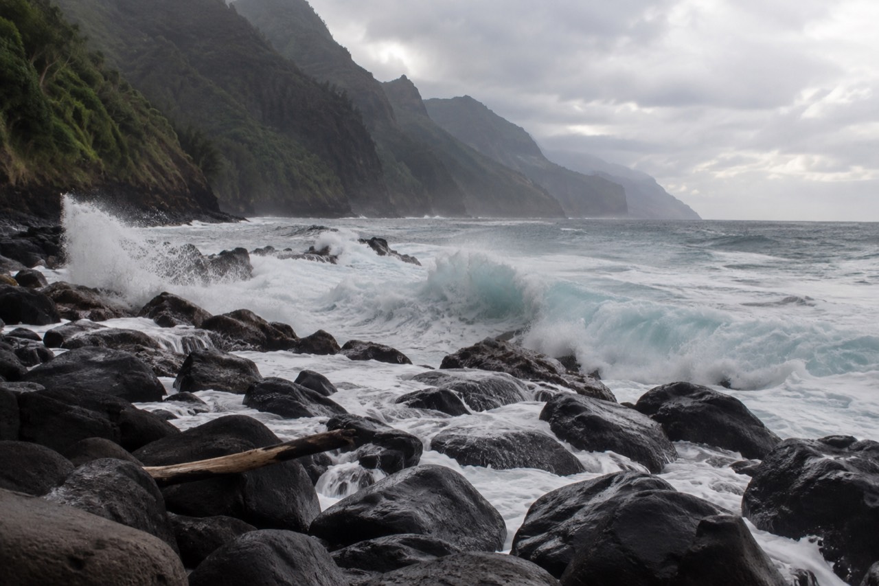
Kauai packs a surprising share of closed, restricted, privately owned or flat-out dangerous coastline and interior into a small island. The state park agency closes its camping at times, its most famous trail requires a permit most visitors never secure, and one of its beaches ranks among the most photographed places in Hawaii that you are legally barred from landing on by kayak. The pattern behind almost all of it is the same: winter ocean, fragile archaeology, private title and a resident population that has watched visitor numbers strain the island's roads and beaches.
Where Should You Not Go On Kauai?
The short list of places to avoid is: the Napali coast trails beyond Hanakapi'ai without an overnight permit, the island of Niihau, the beaches of Napali Coast State Wilderness Park as a kayak landing except at two designated spots, Hanalei Bay's beach park for boat-tour parking, and any north or west facing beach during a high surf advisory. None of these are arbitrary. Each restriction traces back to a documented hazard, a private owner, a state rule or a county ordinance, and the agencies involved publish the reasons. The 6,175 acre Napali Coast State Wilderness Park alone accounts for a large share of the no-go list, because most of it is legally accessible only by boat or by a permitted overnight hike.
That last point deserves emphasis because it is the one visitors most often get wrong. State Parks is explicit that other than hiking the coast, the only legal way to access the shore areas of the wilderness park is by boat, and even then only three named concessionaires may land passengers, at Nu'alolo Kai. Kayaks may land at only two places: Kalalau Valley with a valid camping permit, and Miloli'i. Every other beach in the park, including Hanakapi'ai, Honopu and Nu'alolo Kai, is closed to kayak landings. A traveler who reads "beach" on a map and assumes access will find a ranger, a citation risk, or both.
It is also worth separating "not allowed" from "not wise". The island's winter ocean is the real gatekeeper. The Hanalei wave buoy, moored offshore of the north shore, recorded mean significant wave heights of 2.77 metres in January and 2.61 metres in December across two recent years of data, against 1.50 metres in July. The same months that bring the island's calmest summer water bring almost none of the hazard. Where you should not go in Kauai depends heavily on which month you are standing there, a subject covered in more depth in when not to go to Kauai.
If the coast itself is what you came for, the reliable way to see it is from the water on a permitted tour, and the choice of boat matters more than most first time visitors expect.
The three options above span the range: a sailing catamaran dinner sail, a five hour power catamaran with lunch, and a fast rigid-hull raft for travelers who want the sea caves. Every one of them departs from the island's west side, which is no accident, as the next sections explain.
Which Beaches Are Genuinely Dangerous?
The statistically dangerous beaches are the north shore's remote strands, Hanakapi'ai and Kalalau inside the wilderness park, plus any north or west facing beach when the National Weather Service has issued a high surf advisory, which on Kauai starts at 15 feet for north facing shores and 12 feet for west facing ones. Hawaii Department of Health data covering 2019 to 2023 show that 91 percent of snorkeling drowning victims in the state were visitors, and ocean drownings accounted for 83 percent of all drownings. Kauai's exposure is concentrated on the same north and west shores that take the winter Pacific swell head on.
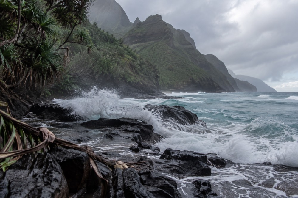
The mechanism is not mysterious. The Hawaiian wave climate runs on north Pacific winter swells from November through March that dominate north and west facing shores, while the calmer months of June through September barely register. Two years of buoy measurements off Hanalei put numbers on it: in June, July, August and September, the share of observations at or above 2.5 metres significant wave height ranged from 0.1 to 1.6 percent. In January it was 52.2 percent. A beach that is a swimming cove in August is a shore break with a strong backwash in January.
| Month | Mean wave height off Hanalei | Share of observations 2.5 m or more | What that means for a visitor |
|---|---|---|---|
| January | 2.77 m | 52.2% | North shore beaches unsafe for swimming most days |
| February | 2.47 m | 47.5% | Same hazard, slightly moderated |
| April | 1.93 m | 16.3% | Genuinely a shoulder month, not a summer month |
| July | 1.50 m | 0.1% | North shore water at its calmest |
| September | 1.42 m | 0.1% | Still excellent |
| November | 2.42 m | 42.6% | The swell returns fast |
Two honest caveats belong with that table. It is two recent years of a single buoy's record, not a 30 year climatology, and the buoy sits offshore in about 200 metres of water, so these are open-ocean sea states rather than breaker heights at the sand. The direction of the finding is solid regardless: the dangerous season on the north shore is real, long, and exactly overlaps whale season, which runs November through April.
The practical rule for any Kauai beach: check the National Weather Service Honolulu forecast, which splits every island into north, west, south and east facing shores and warns each separately, and never judge a beach by the people already in the water. Locals swim spots visitors should not, and visitors drown at rates the state publishes in black and white. If a high surf advisory is up for the shore you are standing on, that beach belongs on your personal no-go list for the day, whatever the guidebook says.
What Is Closed Or Restricted?
The main closures and restrictions are: drone flying in all Hawaii state parks without written DLNR approval, kayak landings anywhere on the Napali coast except Kalalau with a camping permit and Miloli'i, the Nu'alolo Kai shore except with three named raft concessionaires, and camping in Napali Coast State Wilderness Park, which is permitted only at Kalalau Valley with a maximum stay of five consecutive nights. None of these are seasonal suggestions; each is a published rule with an agency behind it.
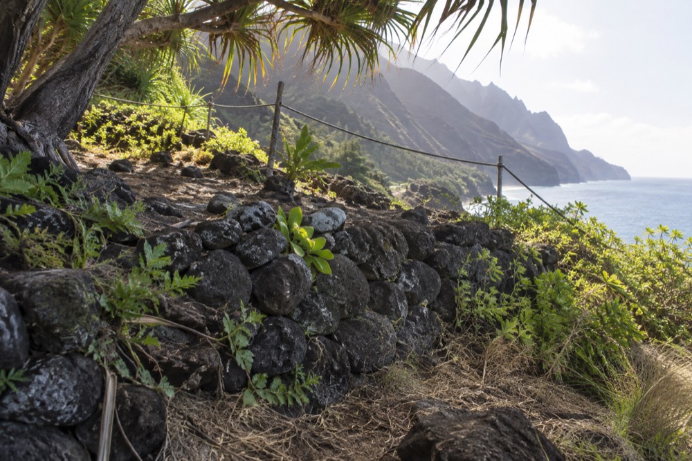
The drone rule surprises the most people. Hawaii Administrative Rules Chapter 13 to 146 prohibits the use, launching or landing of unmanned aircraft systems in all state parks, state beaches, historic parks, recreation areas, forest reserves and natural area reserves without written approval from the Department of Land and Natural Resources. That covers Haena, the Napali coast overlooks and most of the scenic stretches a visitor would want to film. The fine print matters here because the coast is genuinely spectacular from the air, and the temptation to launch from a beach is why the rule exists in the first place, as the state parks rules page makes plain.
The landing rules matter even more. State Parks names the only three companies permitted to land passengers at Nu'alolo Kai: Captain Andy's, Kaua'i Sea Tours and Na Pali Explorer. Everyone else, including every kayak operator, passes the beach without stopping. The archaeology is the reason. Nu'alolo Kai holds an ancient Hawaiian habitation complex that was excavated by Bishop Museum archaeologists across four seasons between 1958 and 1964, and the terraces and stone walls there are fragile in a way that foot traffic compounds. It is a working cultural site, not a beach club.
| Area or activity | Status | Who may access it |
|---|---|---|
| Nu'alolo Kai shore landing | Restricted to three permitted raft concessionaires | Tour passengers on those rafts, conditions permitting |
| Kalalau Valley kayak landing | Allowed only with a valid camping permit | Permitted overnight hikers and kayakers |
| Miloli'i kayak landing | Allowed in summer without a permit | Kayakers, May 15 through September 7 |
| Hanakapi'ai, Honopu, all other park beaches | Kayak landings prohibited | Nobody, by kayak |
| Drone launch in any state park | Prohibited without written DLNR approval | Holders of written approval only |
One more restriction that is easy to miss: commercial boat drop-offs at Kalalau and Miloli'i camping areas are explicitly illegal under state rules, and the state says outright that if you see an advertisement for commercial camping along the Napali coast, it is likely illegal. So the "boat-supported Kalalau camping trip" that occasionally appears in online forums is not a hidden gem, it is an offense.
The coast itself, though, is open water. You do not need a permit to travel along the Napali coast by boat; the permit attaches to going ashore, not to going past. That is precisely why a licensed, permitted boat tour is the clean way to see the coast without stepping on any of the rules above.
Where Does The Road Simply End?
Kauai's road network ends at Haena State Park on the north shore, roughly 41 miles and an hour and a half of driving from Lihue Airport, and at the Kikiaola boat harbor near Waimea and Kekaha on the dry southwest side; beyond those points the Napali coast and the west side cliffs are reachable only by boat, by air, or on foot with a permit. There is no road around the island, and no road will ever be one. The Na Pali cliffs close the northwest quadrant completely.
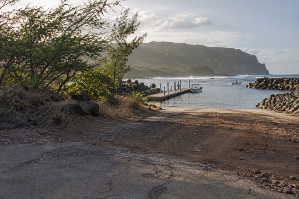
This is the single most useful geographic fact for a Kauai visitor. The island looks circular on a map, but the loop road exists only in the imagination. On the north shore the highway stops at Haena, where the Kalalau Trail begins. On the west side the road runs out near Kekaha at Kikiaola Small Boat Harbor, which offers four moorings limited to vessels with a draft under three feet, a ramp, a washdown and restrooms. Between those two endpoints, 16 miles of protected coastline belong to the wilderness park.
The two ends could not feel more different. The Haena end is wet, jungled and permit gated, and the road to it backs up badly in peak months. The Kikiaola end is dry, quiet and functional, and it is where several of the island's raft operators dock. This split is why the question of which side to launch from matters so much for boat tours, a comparison covered in north shore versus west side boat tours.
Because the road ends where it does, the sunset hours on the west side are unusually accessible. A boat that leaves Port Allen in the late afternoon reaches open water inside half an hour, and the coast's cliffs catch the low sun from an angle no north shore viewpoint can match.
What About Private Land?
The big one is Niihau, the island off Kauai's southwest coast, which is privately owned and has no public visitor access; its 2020 census population was 84 people, and the only legal ways to see it are boat tours that cruise its shoreline and snorkel at neighbouring Lehua, a state seabird sanctuary where landing is restricted to areas below the high water mark. Niihau is not a hidden beach waiting to be discovered. It is a functioning Hawaiian community with an owner, and the census tract definition itself implies no public access.
Kauai itself carries less private-land friction than visitors expect, but it exists. Large stretches of the west side sit under agricultural leases, and the county's transient vacation rental rules shape where visitors may lawfully stay: vacation rentals outside designated Visitor Destination Areas require a Nonconforming Use Certificate or a Homestay permit, and new ones are permitted by right only inside the designated areas, per the Kauai County Planning Department. The practical effect for a traveler is that a suspiciously cheap rental listing in a residential neighbourhood may be an illegal one, and booking it puts you in the middle of a local dispute you did not sign up for.
The water side of private land matters too. Lehua Island, the crescent crater off Niihau's north tip, is a state designated seabird sanctuary managed by the Division of Forestry and Wildlife, with federal ownership by the U.S. Coast Guard, and landing is restricted to areas below the high water mark. It was declared rat free in April 2021 after a 2017 eradication effort, and the restoration work there is ongoing. Boat tours approach it and snorkel its reefs, which is the sanctioned way to see it.
The honest summary: on Kauai, "private" mostly means Niihau, some ranch land and the county's vacation rental map. Respect the first two by not trying, and the third by booking legal lodging, and private land will never be the reason your trip goes wrong.
Which Trails Are Riskier Than They Look?
The Kalalau Trail is the one that catches people out: the first two miles to Hanakapi'ai Beach are a popular day hike needing only a Haena entry reservation, but beyond Hanakapi'ai the trail is illegal to continue on without a valid overnight camping permit, and the full 11 mile route to Kalalau takes most hikers a full day each way. The trail does not look like a permit boundary at the Hanakapi'ai stream crossing. It is one anyway, and rangers do check.
The permit system is strict and it is genuinely hard to book in summer. Camping permits for the wilderness park are issued only for Kalalau Valley, at 35 dollars per person per night for non residents and 25 dollars for Hawaii residents, a maximum of five consecutive nights, bookable up to 90 days in advance, and the state warns they often sell out months ahead. Access to the trailhead itself runs through Haena State Park, where non residents need a 5 dollar per person entry reservation plus a 10 dollar per vehicle parking reservation, opening 30 days in advance, while residents enter free with ID.
| Trail or section | Permit needed | Fee | Notes |
|---|---|---|---|
| Trailhead to Hanakapi'ai Beach (2 miles) | Haena entry reservation only | $5 per person, $10 to park | Day hike; no camping permit needed |
| Hanakapi'ai to Kalalau (9 more miles) | Overnight camping permit | $35 per night, non residents | Illegal without it; sells out months ahead |
| Kalalau camping | Same permit | Max 5 consecutive nights | Bookable 90 days in advance |
| Miloli'i camping | Separate permit | Summer season | Accessible only by watercraft |
The risk is not only legal. The trail's reputation for danger is earned in the winter months, when stream crossings rise and the same north swells that close beaches make the coastal sections exposed. Hanakapi'ai Beach itself, the turnaround point for most day hikers, sits on a north facing shore with no lifeguard, which places it squarely in the winter hazard zone described earlier. The state's own guidance that a full Kalalau hike takes a fit backpacker a full day is a hint that the Instagram version and the real version are different products.
Other trails carry quieter risks. Any trail on the west side, including the paths above Waimea Canyon, combines heat with zero shade and no water, and the county's search and rescue calls cluster on exactly those hot, dry afternoons. The rule of thumb locals use: if the forecast shows trades, hike early; if it shows a Kona wind and high surf, the coast trails and the beaches behind them are both off.
What Do Locals Ask Visitors To Respect?
The asks that come up again and again are: do not park at Hanalei Bay beach park for a boat activity, which the county does not allow and operators work around with office parking and shuttles; do not touch or approach Hawaiian monk seals, with recommended distances of 50 feet, or 150 feet for mothers with pups; and do not bring oxybenzone or octinoxate sunscreen, which Hawaii law prohibits selling without a prescription. None of these are etiquette. Each one is a rule with an agency or a statute behind it.
The Hanalei parking rule is the one that most directly touches boat tours. The County of Kauai does not allow parking at the beach park for boat activities, so the north shore operator parks guests at its office in Hanalei's Ching Young Village and shuttles them to the bay, where boarding is a wet one: passengers must be able to wade through water and climb a four step ladder unassisted. That detail alone filters out some travelers, and it is a good example of why reading the fine print matters, a theme expanded in what to be careful of in Kauai.
The wildlife rules are federal as well as local. Vessels may not approach within 100 yards of a humpback whale anywhere within 200 nautical miles of Hawaii, and within 2 nautical miles of the main islands it is unlawful to swim with or approach within 50 yards of a Hawaiian spinner dolphin. Monk seals, of which the Niihau and Lehua surveys counted 70 to 73 animals in 2024, rest on Kauai beaches, and the recommended 50 foot distance is enforced by presence as much as by ticket. Green sea turtles have no open season at all.
The sunscreen law is easy to comply with and widely ignored anyway. Hawaii Act 104 prohibits the sale or distribution of sunscreens containing oxybenzone or octinoxate without a prescription, effective since January 1, 2021, and no Kauai County ordinance exists, so the statewide rule is the one that applies on this island. Bring mineral sunscreen, or buy it here.
The deeper request behind all of these is simple: Kauai's resident population is vastly outnumbered by its visitors in peak months, and the restrictions in this article exist because the island's natural and cultural resources cannot absorb unlimited footfall. Following the posted rules is not deference, it is the price of the place staying worth visiting.
Where Should You Go Instead?
Go to the places built for visitors without ruining what they show: the west side harbors and their boat tours, the permitted day hike to Hanakapi'ai with a Haena reservation, Waimea Canyon's drive-up lookouts, and the legal south shore beaches, which sit in the island's lee during the dangerous north shore months. Every no-go area on this page has a sanctioned alternative within a short drive, and most of them are better experiences than the thing they replace.
The strongest example is the coast itself. You cannot land on the Napali beaches, you cannot kayak most of them, and you cannot drive to any of them, but you can ride a licensed boat the full 16 miles and see all of it, with a captain who knows which cave the swell allows today. The five hour Amelia K catamaran tour from Port Allen, rated 4.9 from 2,050 reviews with lunch included, covers the sightseeing, the sea caves when conditions permit and a snorkel stop, which is more of the coast than any day hiker legally sees.
For the winter months specifically, the southwest side is the island's sheltered quarter, and that is why 18 of the island's Napali boat tours leave Port Allen and 8 more leave nearby Kikiaola rather than the exposed north shore. A sunset dinner sail from Port Allen gives you the cliffs in golden light without a single permit, reservation or wet boarding, and the harbor's free gravel lot is a genuinely pleasant surprise after reading about Haena's timed parking slots.
The land alternatives hold up too. Hanakapi'ai is a fine day hike with just the Haena reservation, and turning around there is both legal and sensible. Waimea Canyon's main lookouts are drive-up. Poipu's beaches face south, which in the winter swell regime is the calm quadrant. The island is not trying to keep you out; it is asking you to enter where the doors are open, and the view from a boat on a legal tour is the best door of all, as Napali Coast Boat Tours lays out across its tour guides.
Common Questions About Where Not To Go In Kauai?
Where Not To Go In Kauai?
Avoid the Napali coast beyond Hanakapi'ai without an overnight permit, the island of Niihau, kayak landings on any Napali beach except Kalalau with a permit and Miloli'i, Hanalei beach park parking for boat tours, drone launches in any state park, and any north or west facing beach during a high surf advisory.
Can You Hike To Kalalau Beach Without A Permit?
No. The first two miles to Hanakapi'ai Beach need only a Haena State Park entry reservation, but beyond Hanakapi'ai a valid overnight camping permit is required with no exceptions. Permits cost 35 dollars per person per night for non residents and open 90 days in advance.
Is Hanakapi'ai Beach Dangerous?
It can be. It sits on a north facing shore with no lifeguard, and the offshore buoy record shows winter wave heights at or above 2.5 metres in roughly half of January and December observations. In summer it is usually a calm cove; in winter it belongs on the no-go list.
Can Tourists Visit Niihau?
Not on your own. Niihau is privately owned with no public visitor access and a 2020 census population of 84. The legal way to see it is a boat tour that cruises its shoreline and snorkels near Lehua, the seabird sanctuary off its north tip.
Why Can't You Land A Kayak On The Napali Coast Beaches?
State Parks allows kayak landings at only two places, Kalalau Valley with a camping permit and Miloli'i. All other beaches in the park, including Hanakapi'ai, Honopu and Nu'alolo Kai, are closed to kayak landings to protect fragile archaeological sites and unsafe shore conditions.
Where Should You Go Instead?
Take a licensed boat tour from Port Allen or Kikiaola, hike the permitted two miles to Hanakapi'ai, visit Waimea Canyon's lookouts, or use the south shore beaches, which sit in the island's lee during the winter's dangerous north and west swells.